Dispatch: Smoke investigation, 9000 Portola State Park Rd, La Honda, CA, April 1, 2021
A member of the public called 911 on a smoke plume visible from their home on Burns Valley Road. It was already late (quickly approaching dusk). The dispatch location was given as 9000 Portola State Park Rd in La Honda. This is the location of the main office of a local park.
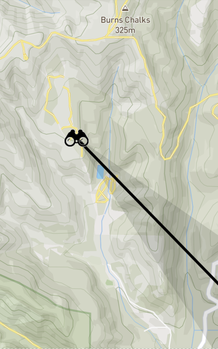
Knowing the area, we know that’s a terrible place to go for a good vantage point on the possible fire. We head up to Haskin’s Hill instead, which has a good panoramic view of the valley. On the way there, the person who called 911 downloaded Smoke Point (remembering they saw an email about it) and snapped a picture. The reading (below left) appeared on our app on the way up the hill.
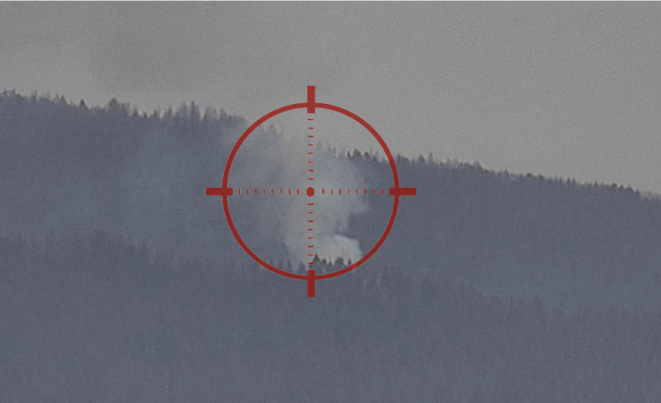
We did see what we thought might be a smoke plume off in the distance, but it was spread out and could have been mistaken for a cloud. Adding some additional readings of our own confirmed that what we were seeing was the same as what the reporting party saw. This gave us confidence.
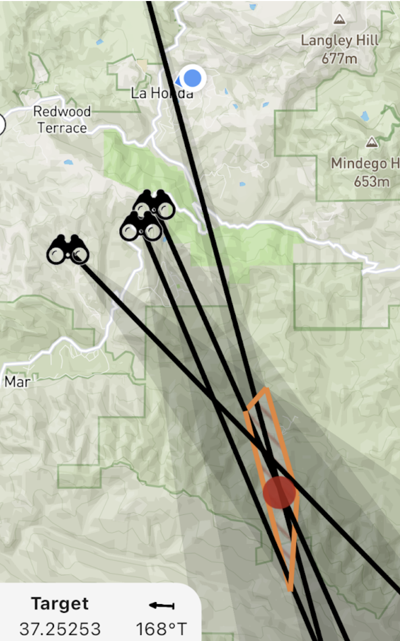
Adding in a wildfire camera image (above right) which could barely see the column helped even further and got us an approximate location (above center). At this point it was dark.
We had confirmed that the spot was inside the already-burnt (black) part of the CZU Lightning Complex fires of 2020 (yes, over six months later, still burning). Access from the north (where we were) was blocked due to bad road conditions. The chief in charge decided to send crews and a helicopter out the following morning when they were more likely to be able to find it.

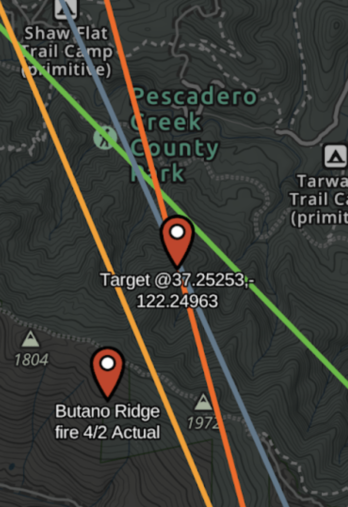

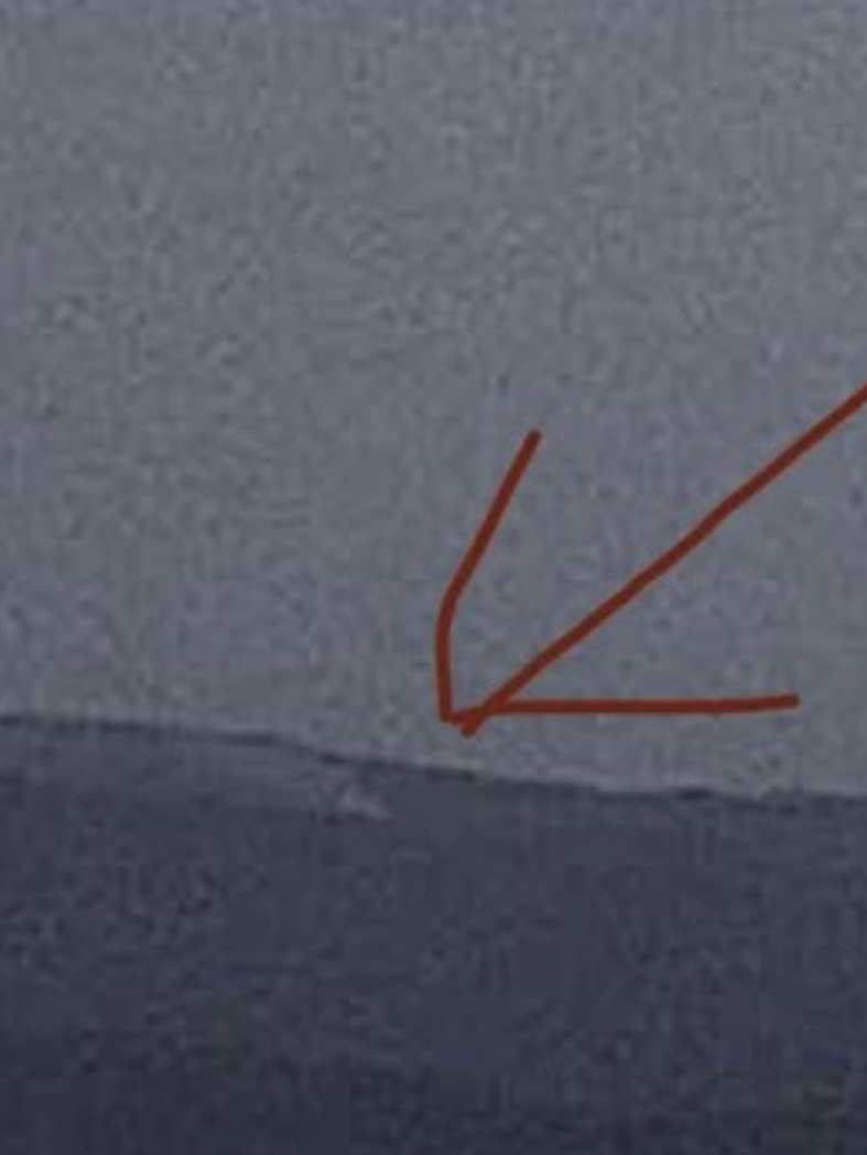
And so, the next morning, a helicopter grabbed the precise coordinates of the fire, which was then quite visible (see right). Comparing the target calculated by Smoke Point to the ground truth showed it off by over half a mile with the actual fire to the south and west (see pin above labeled Butano Ridge fire 4/2 Actual relative to the pin labeled Target).
Why the error? A few factors contributed:
- We were to the north and a little west of the smoke.
- Wind was traveling due east at the time.
- The smoke column had turned into a leaned-over plume, spreading out horizontally.
- It was near dark, and the fire over a ridge, making it difficult to see what side of the plume was the source.
So, we all just picked a spot to target: the center of the plume, which would have been east of the actual fire due to the wind. Above you can see about what we saw: an ill-defined thing on the horizon that wasn’t a cloud.
Lessons learned:
- I should add wind conditions to the app when taking a reading so the user can answer the question: should I target the left side, or the right side, of the plume when it is obscured?
