Dispatch: Grass fire, Butano Ridge & Old Haul Rd, Loma Mar, CA
A fire was spotted and units dispatched. The dispatcher in San Mateo County gave the location as on Butano Ridge in Loma Mar. I pulled up Smoke Point to see if anyone had spotted the fire using the app. A few people had! One of the examples is on the left. Immediately I knew this was real and gave me a general area.
Triangulation is best done using the wildfire cameras, if possible: the headings acquired from them are significantly more accurate. One camera could obviously see it (image on right).
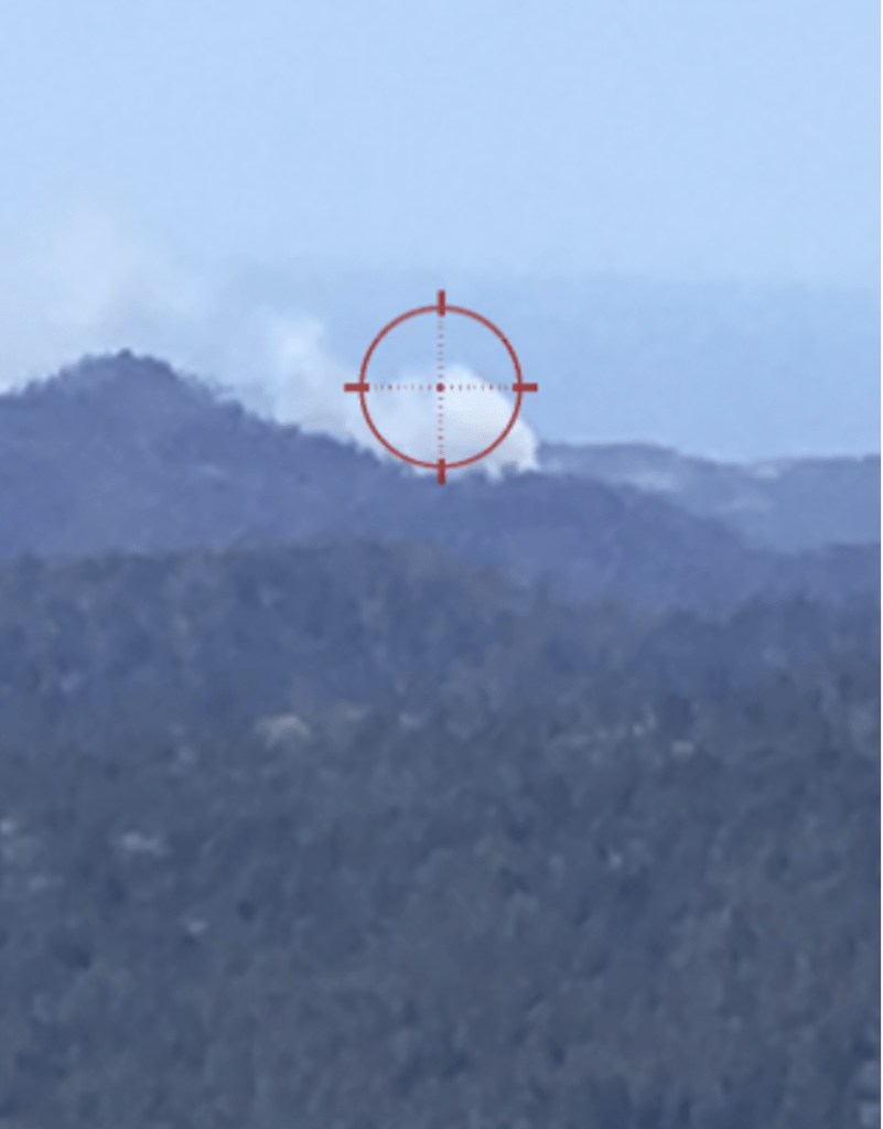
A member of the public took this shot with Smoke Point. 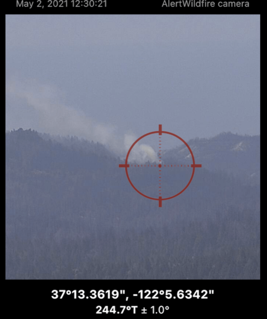
The same fire from a wildfire camera.
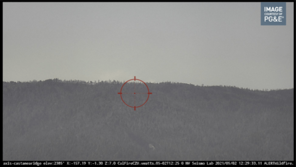
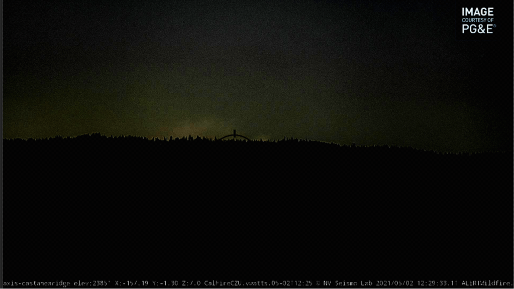
I suspected another specific camera would be able to see it based on the camera’s relative location to the reported fire, so I pulled it up. It was very hard to tell, but it did seem like there might be some smoke. I could only tell because I watched several image updates and watched how it changed frame-by-frame. Observe how there is the slightest difference in color in the sky above the crosshairs (it’s very subtle):
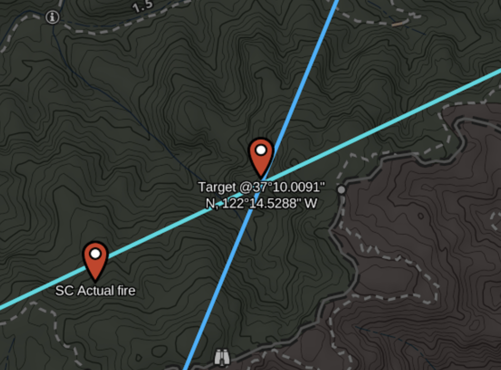
The triangulation put the fire nowhere near Butano Ridge but instead south near Hwy 9 in Santa Cruz County. I thought, “Oh well there must be two fires”. Once the en-route helicopter found the fire, they relayed the correct location, which was within about a third of a mile of the triangulated position:
This is all information I had within a minute of dispatch. Before leaving the station, I knew approximately where this fire was. I just thought I was en-route to a different one that I couldn’t see. Ten minutes later, a helicopter pinpointed the fire, and the San Mateo County assignment was canceled because the fire was one county to the south: using available camera imagery and triangulation, I knew this, and without flying a helicopter.
So why was the triangulation even a third of a mile off? The light blue line above is from the first camera (with the clear image). It nearly intersects with the real fire location. The darker blue line is from the second camera (with the low contrast image). It turns out the position in the second camera image I chose was not quite at the source of the fire, but a few degrees off. I had to make a guess. Applying a contrast-enhancing filter to the second image showed where the smoke really was:
You can see here that the position I chose for the crosshairs was too far “left”. Had I chosen the right-most visible smoke the triangulated position would have been near perfect.
Lessons learned:
- Smoke Point gave me intel 10 minutes before the rest of the assignment, and all from a smart phone without moving.
- Being able to manipulate the camera images to highlight smoke like this may be valuable – but it is definitely a niche feature.
- The wind direction feature is still a good candidate. In this case, I had a sense of wind direction by looking at the other camera image and how the smoke was leaning over, but better not to have go figure that out at all.
