Version 2.1 is out. The app to no longer accepts readings from inside or near cars. It now also allows use without location permissions: some features won’t be available until permissions are granted.
Why restrict readings in or near cars? San Mateo County recently had a prescribed burn. Two firefighters used Smoke Point on their phones. One was inside their car, and one was a short distance from a row of fire engines.


Now look at the directions the phone compasses reported for these two readings. The intersection of the black lines indicate where the fire was actually started.
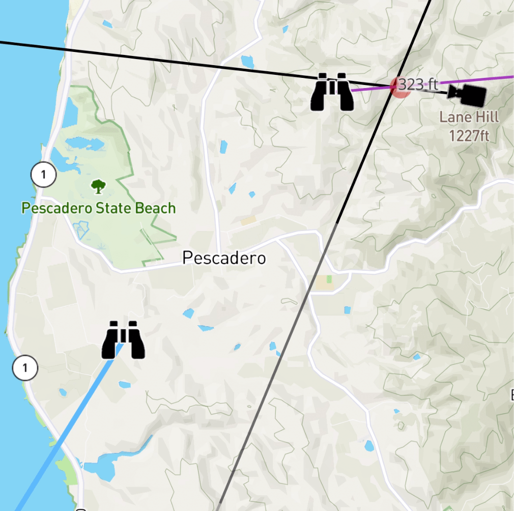
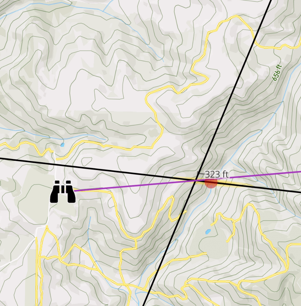
On the left is the reading from inside the car (with the blue line). On the right is the one from outside (purple line).
Based on the data collection we’ve done, 1% of the time these in- or near-car compass readings can be worse than +/- 60°. Given there is a great alternative that produces better data, it’s not worth allowing in-car readings at all.
As always, please email gabe@smokepoint.app with questions or comments.

One thought on “Version 2.1: out of that car!”